
Thank you for supporting this site ❤️
Make a donation
Make a donation
Gear up for your next adventure:
As an Amazon Associate, this site earns from qualifying purchases at no extra cost to you.
Veracruz topographic map
Click on the map to display elevation.
Thank you for supporting this site ❤️
Make a donation
Make a donation
Gear up for your next adventure:
As an Amazon Associate, this site earns from qualifying purchases at no extra cost to you.
About this map
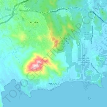
Name: Veracruz topographic map, elevation, terrain.
Location: Veracruz, Distrito de Arraiján, Panamá Oeste, Panama (8.87903 -79.65464 8.95650 -79.55983)
Average elevation: 223 ft
Minimum elevation: -10 ft
Maximum elevation: 1,634 ft
Thank you for supporting this site ❤️
Make a donation
Make a donation
Gear up for your next adventure:
As an Amazon Associate, this site earns from qualifying purchases at no extra cost to you.