
Thank you for supporting this site ❤️
Make a donation
Make a donation
Gear up for your next adventure:
As an Amazon Associate, this site earns from qualifying purchases at no extra cost to you.
Coamazac topographic map
Click on the map to display elevation.
Thank you for supporting this site ❤️
Make a donation
Make a donation
Gear up for your next adventure:
As an Amazon Associate, this site earns from qualifying purchases at no extra cost to you.
About this map
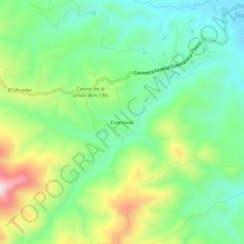
Name: Coamazac topographic map, elevation, terrain.
Location: Coamazac, Taxco de Alarcón, Guerrero, 62640, México (18.58222 -99.50194 18.62222 -99.46194)
Average elevation: 3,688 ft
Minimum elevation: 3,219 ft
Maximum elevation: 4,590 ft
Thank you for supporting this site ❤️
Make a donation
Make a donation
Gear up for your next adventure:
As an Amazon Associate, this site earns from qualifying purchases at no extra cost to you.