Geolocate

Presilla topographic map

Click on the map to display elevation.

About this map

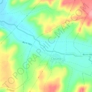
Name: Presilla topographic map, elevation, terrain.

Location: Presilla, Cayuela, Burgos, Castile and León, 09514, Spain (42.26673 -3.83428 42.28673 -3.81428)

Average elevation: 2,789 ft

Minimum elevation: 2,644 ft

Maximum elevation: 3,018 ft

Gear up for your next adventure:

📷Action Cameras - Rugged cameras to document your journeys across rugged terrain
🦺Reflective Outdoor Gear - Safety gear for low‑light conditions
👟Men's Trail Runners - Lightweight footwear for fast-paced exploration and light hiking
🪶Fire Starter Kit - Reliable fire starter for survival and camping
🥾Women's Hiking Boots - Top-rated trail boots with ankle support and superior grip

As an Amazon Associate, this site earns from qualifying purchases at no extra cost to you.