
Thank you for supporting this site ❤️
Make a donation
Make a donation
Gear up for your next adventure:
As an Amazon Associate, this site earns from qualifying purchases at no extra cost to you.
昌盖 topographic map
Click on the map to display elevation.
Thank you for supporting this site ❤️
Make a donation
Make a donation
Gear up for your next adventure:
As an Amazon Associate, this site earns from qualifying purchases at no extra cost to you.
About this map
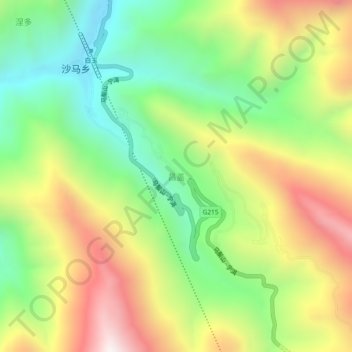
Name: 昌盖 topographic map, elevation, terrain.
Location: 昌盖, དཔལ་ཡུལ་རྫོང་ 白玉县, 甘孜藏族自治州, Sichuan, China (30.55858 99.17782 30.59858 99.21782)
Average elevation: 12,881 ft
Minimum elevation: 11,227 ft
Maximum elevation: 15,085 ft
Thank you for supporting this site ❤️
Make a donation
Make a donation
Gear up for your next adventure:
As an Amazon Associate, this site earns from qualifying purchases at no extra cost to you.