Geolocate

Twisp topographic map

Click on the map to display elevation.

About this map

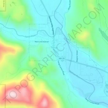
Name: Twisp topographic map, elevation, terrain.

Location: Twisp, Okanogan County, Washington, 98856, United States (48.34857 -120.13358 48.37439 -120.08488)

Average elevation: 1,903 ft

Minimum elevation: 1,532 ft

Maximum elevation: 2,956 ft

Okanogan County trails, hiking, mountain biking, running and outdoor activities

Other topographic maps

Click on a map to view its topography, its elevation and its terrain.

Wauconda

United States > Washington > Okanogan County

Average elevation: 3,881 ft

Havillah

United States > Washington > Okanogan County

Average elevation: 3,665 ft

Mount Barney

United States > Washington > Okanogan County

Average elevation: 6,683 ft

Aeneas Mountain

United States > Washington > Okanogan County

Average elevation: 4,117 ft

Point Defiance

United States > Washington > Okanogan County

Average elevation: 6,033 ft

Baker Mountain

United States > Washington > Okanogan County

Average elevation: 2,959 ft

Mission Peak

United States > Washington > Okanogan County

Average elevation: 4,816 ft

Rock Mountain

United States > Washington > Okanogan County

Average elevation: 7,067 ft

Gear up for your next adventure:

🪶Survival Guide Book - Expert advice for emergency preparedness
🚑Emergency Bivvies - Heat-reflective sleeping bags for survival situations
📱Heavy-Duty Phone Cases - Drop-proof and waterproof protection for outdoor navigation
🔥Fast-Boil Camping Stoves - Efficient cooking systems for quick trail meals
🏕️Tent Footprint - Protect your tent base from wear

As an Amazon Associate, this site earns from qualifying purchases at no extra cost to you.