Geolocate

Dabugan topographic map

Click on the map to display elevation.

About this map

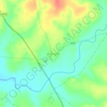
Name: Dabugan topographic map, elevation, terrain.

Location: Dabugan, Nabarangapur, Odisha, India (19.43753 82.39210 19.47753 82.43210)

Average elevation: 1,962 ft

Minimum elevation: 1,896 ft

Maximum elevation: 2,064 ft

Gear up for your next adventure:

🗺️NatGeo Topo Maps - High-quality waterproof printed topographic maps of US Parks
🧭Compass with Lanyard - Easy‑carry compass for navigation
📶Satellite Messenger - Communication device off‑grid
🥾Hiking Shoes - Durable and comfortable shoes for trail hiking
🪶Wildlife Field Guides - Learn animal tracking and species ID

As an Amazon Associate, this site earns from qualifying purchases at no extra cost to you.