Geolocate

Mochdre topographic map

Click on the map to display elevation.

About this map

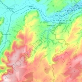
Name: Mochdre topographic map, elevation, terrain.

Location: Mochdre, Stepaside, Powys, Wales, United Kingdom (52.42977 -3.41339 52.52629 -3.34451)

Average elevation: 955 ft

Minimum elevation: 331 ft

Maximum elevation: 1,824 ft

Gear up for your next adventure:

🌡️Handheld Weather Meters - Measure wind, temp, and pressure for safe mountain travel
🔥Plasma Lighters - Windproof lighters that work in any weather condition
🌲Outdoor Survival Books - Best books on survival skills
🔋Solar Power Banks - Keep your GPS and phone charged in remote wilderness areas
🔭Telescopic Hiking Pole - Adjustable pole for hiking stability

As an Amazon Associate, this site earns from qualifying purchases at no extra cost to you.