Geolocate

El Alto topographic map

Click on the map to display elevation.

About this map

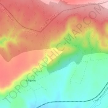
Name: El Alto topographic map, elevation, terrain.

Location: El Alto, Sigüenza, Guadalajara, Castile-La Mancha, Spain (41.12396 -2.58103 41.14396 -2.56103)

Average elevation: 3,704 ft

Minimum elevation: 3,366 ft

Maximum elevation: 4,019 ft

Gear up for your next adventure:

🔌Solar Panel Charger - Charge gear sustainably outdoors
🔌USB Car Charger - Car charger for on‑the‑go power needs
🩹Survival Bandages - High‑quality bandages for emergencies
🪶Survival Guide Book - Expert advice for emergency preparedness
🗺️Topographic Maps - Detailed topo maps for hiking, exploring and outdoor navigation

As an Amazon Associate, this site earns from qualifying purchases at no extra cost to you.