Geolocate

Las Cañadas topographic map

Click on the map to display elevation.

About this map
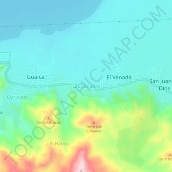
Name: Las Cañadas topographic map, elevation, terrain.

Location: Las Cañadas, Parroquia Güigüe, Municipio Carlos Arvelo, Carabobo State, 2010, Venezuela (10.06531 -67.83847 10.10531 -67.79847)

Average elevation: 1,575 ft

Minimum elevation: 1,329 ft

Maximum elevation: 2,323 ft

Other topographic maps

Click on a map to view its topography, its elevation and its terrain.

Gear up for your next adventure:

🪶Camp Gear Gift Set - Perfect gift bundle for outdoor fans
🧭Outdoor Navigation Book - Learn advanced navigation skills
🎒Hydration Pack - Hands‑free water reservoir for long hikes
🪶Wildlife Field Guides - Learn animal tracking and species ID
🧯Portable Fire Pit - Compact fire pit for camping spots

As an Amazon Associate, this site earns from qualifying purchases at no extra cost to you.