Geolocate

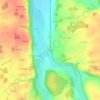
Levis topographic map

Click on the map to display elevation.

About this map
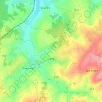
Name: Levis topographic map, elevation, terrain.

Location: Levis, Auxerre, Yonne, Bourgogne – Franche-Comté, Metropolitan France, 89520, France (47.63460 3.28970 47.68080 3.37199)

Average elevation: 833 ft

Minimum elevation: 663 ft

Maximum elevation: 1,066 ft

Other topographic maps

Click on a map to view its topography, its elevation and its terrain.

Les Huees

France > Bourgogne – Franche-Comté > Yonne > Tonnerre

Average elevation: 748 ft

Sixte

France > Bourgogne – Franche-Comté > Yonne > Michery

Average elevation: 230 ft

Anus

France > Bourgogne – Franche-Comté > Yonne > Fouronnes

Average elevation: 758 ft

L'Ormeau

France > Bourgogne – Franche-Comté > Yonne > Vaudeurs

Average elevation: 705 ft

Bapaume

France > Bourgogne – Franche-Comté > Yonne > Dollot

Average elevation: 489 ft

Crai

France > Bourgogne – Franche-Comté > Yonne > Chamoux

Average elevation: 807 ft

Gear up for your next adventure:

🔭Compact Binoculars - HD vision for scouting terrain and identifying distant landmarks
🔪Outdoor Multitools - Essential survival tools for gear repair and field use
🪶Wildlife Field Guides - Learn animal tracking and species ID
🥘Titanium Cookware - Durable, featherlight pots and pans for backpacking
🗻Climbing Gear Basics - Essential gear for beginner climbers

As an Amazon Associate, this site earns from qualifying purchases at no extra cost to you.