
Redwater topographic map
Interactive map
Click on the map to display elevation.
About this map
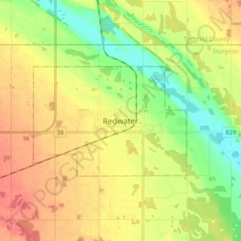
Name: Redwater topographic map, elevation, terrain.
Location: Redwater, Town of Redwater, Alberta, T0A 2W0, Canada (53.91275 -113.15249 53.99275 -113.07249)
Average elevation: 2,067 ft
Minimum elevation: 1,972 ft
Maximum elevation: 2,159 ft