Geolocate

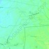
Sulipan topographic map

Click on the map to display elevation.

About this map

Name: Sulipan topographic map, elevation, terrain.

Location: Sulipan, Apalit, Pampanga, Central Luzon, 2016, Philippines (14.92799 120.74348 14.94818 120.77035)

Average elevation: 13 ft

Minimum elevation: -3 ft

Maximum elevation: 26 ft

Other topographic maps

Click on a map to view its topography, its elevation and its terrain.
Paligui

Philippines > Pampanga > Apalit

Average elevation: 10 ft

Capalangan

Philippines > Pampanga > Apalit

Average elevation: 16 ft

Calantipe

Philippines > Pampanga > Apalit

Average elevation: 30 ft

Gear up for your next adventure:

🪑Ultralight Camp Chairs - Portable seating for resting after a long day of mapping
🧣Merino Neck Gaiters - Multi-functional headwear for wind and sun protection
🗺️NatGeo Topo Maps - High-quality waterproof printed topographic maps of US Parks
🔌Solar Panel Charger - Charge gear sustainably outdoors
🌡️Portable Weather Meter - Track weather conditions on the trail

As an Amazon Associate, this site earns from qualifying purchases at no extra cost to you.