Geolocate

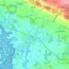
Talhouët topographic map

Click on the map to display elevation.

About this map

Name: Talhouët topographic map, elevation, terrain.

Location: Talhouët, Theix, Theix-Noyalo, Vannes, Morbihan, Bretagne, France métropolitaine, 56450, France (47.64007 -2.70043 47.68007 -2.66043)

Average elevation: 92 ft

Minimum elevation: 0 ft

Maximum elevation: 325 ft

Other topographic maps

Click on a map to view its topography, its elevation and its terrain.
Theix

France > Bretagne > Morbihan > Theix-Noyalo

Average elevation: 95 ft

Theix

France > Bretagne > Morbihan > Theix-Noyalo

Average elevation: 95 ft

Gear up for your next adventure:

🌄Hiking Binoculars - Compact binoculars for scenic views and trail spotting
🔭Compact Binoculars - HD vision for scouting terrain and identifying distant landmarks
🧤Tactile Hiking Gloves - Keep hands warm while operating GPS and smartphone screens
⌚Solar GPS Watches - Advanced multisport watches with built-in topographic maps
🥤Water Filter Bottle - All‑in‑one filter bottle for safe hydration

As an Amazon Associate, this site earns from qualifying purchases at no extra cost to you.