Geolocate

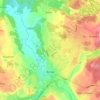
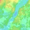
Suchorze topographic map

Click on the map to display elevation.

About this map

Name: Suchorze topographic map, elevation, terrain.

Location: Suchorze, gmina Trzebielino, Bytów County, Pomeranian Voivodeship, 77-233, Poland (54.25548 17.07916 54.29548 17.11916)

Average elevation: 420 ft

Minimum elevation: 305 ft

Maximum elevation: 535 ft

Other topographic maps

Click on a map to view its topography, its elevation and its terrain.
Miastko

Poland > Pomeranian Voivodeship > Bytów County

Average elevation: 459 ft

Bytów

Poland > Pomeranian Voivodeship > Bytów County

Average elevation: 482 ft

Gear up for your next adventure:

🧤Hiking Gloves - Protective gloves for rugged trails
🔋Rechargeable Batteries - Power up your outdoor devices
🪑Portable Camp Table - Compact table for campsite meals
🗻Climbing Gear Basics - Essential gear for beginner climbers
📦Dry Bags Set - Waterproof storage for electronics and clothes

As an Amazon Associate, this site earns from qualifying purchases at no extra cost to you.