Geolocate

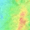
Enschede topographic map

Click on the map to display elevation.

About this map
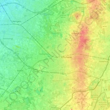
Name: Enschede topographic map, elevation, terrain.

Location: Enschede, Overijssel, Netherlands (52.16121 6.75589 52.28551 6.98110)

Average elevation: 118 ft

Minimum elevation: 43 ft

Maximum elevation: 226 ft

Other topographic maps

Click on a map to view its topography, its elevation and its terrain.
Lonneker

Netherlands > Overijssel > Enschede

Average elevation: 154 ft

Schoolbuurt

Netherlands > Overijssel > Markelo

Average elevation: 56 ft

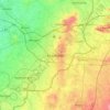
Enschede

Netherlands > Overijssel > Enschede

Average elevation: 112 ft

Lemelerberg

Netherlands > Overijssel > Lemele

Average elevation: 62 ft

Frankhuis

Netherlands > Overijssel > Zwolle

Average elevation: 10 ft

Usselo

Netherlands > Overijssel > Enschede

Average elevation: 102 ft

Tankenberg

Netherlands > Overijssel > de Lutte

Average elevation: 190 ft

Zuurberg

Netherlands > Overijssel > Holten

Average elevation: 56 ft

Helhuizen

Netherlands > Overijssel > Holten

Average elevation: 66 ft

Witteberg

Netherlands > Overijssel

Average elevation: 187 ft

Gear up for your next adventure:

🧭Orienteering Set - Complete compass and map reading kit
🪶Trail Camera - Capture wildlife on your hikes
🔭Stargazing Telescopes - Perfect for camping in low-light pollution areas shown on maps
🔥Camping Stove - Portable stove for camping and backcountry cooking
🪶Fire Starter Kit - Reliable fire starter for survival and camping

As an Amazon Associate, this site earns from qualifying purchases at no extra cost to you.