Geolocate

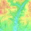
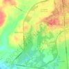
Bethune topographic map

Click on the map to display elevation.

About this map

Name: Bethune topographic map, elevation, terrain.

Location: Bethune, Kershaw County, South Carolina, United States (34.40559 -80.35918 34.42396 -80.33717)

Average elevation: 282 ft

Minimum elevation: 226 ft

Maximum elevation: 318 ft

Kershaw County trails, hiking, mountain biking, running and outdoor activities

Other topographic maps

Click on a map to view its topography, its elevation and its terrain.

Hyco

United States > South Carolina > Kershaw County

Average elevation: 312 ft

Pine Creek

United States > South Carolina > Kershaw County

Average elevation: 240 ft

Cassatt

United States > South Carolina > Kershaw County

Average elevation: 367 ft

Flat Rock

United States > South Carolina > Kershaw County

Average elevation: 433 ft

Dusty Bend

United States > South Carolina > Kershaw County > Camden

Average elevation: 240 ft

Cassatt

United States > South Carolina > Kershaw County

Average elevation: 367 ft

Gear up for your next adventure:

🦶Hiking Gaiters - Keep debris and water out of your boots
🌡️Portable Weather Meter - Track weather conditions on the trail
📦Gear Storage Bags - Organize and protect outdoor equipment
🧭Compass with Lanyard - Easy‑carry compass for navigation
🏕️Family Camping Gear - Essentials for group camping trips

As an Amazon Associate, this site earns from qualifying purchases at no extra cost to you.