
Hunningham topographic map
Click on the map to display elevation.
About this map
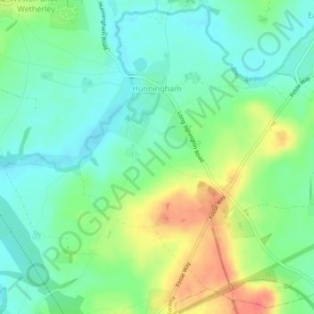
Name: Hunningham topographic map, elevation, terrain.
Location: Hunningham, Warwick, Warwickshire, England, United Kingdom (52.29363 -1.46225 52.31973 -1.41868)
Average elevation: 240 ft
Minimum elevation: 177 ft
Maximum elevation: 344 ft
Other topographic maps
Click on a map to view its topography, its elevation and its terrain.
Rowington Green
United Kingdom > England > Warwickshire > Warwick > Rowington
Average elevation: 374 ft
Hampton on the Hill
United Kingdom > England > Warwickshire > Warwick > Hampton on the Hill
Average elevation: 246 ft
Hill Wootton
United Kingdom > England > Warwickshire > Warwick > Leek Wootton
Average elevation: 226 ft