Geolocate

Zoutelande topographic map

Click on the map to display elevation.

About this map

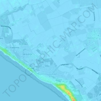
Name: Zoutelande topographic map, elevation, terrain.

Location: Zoutelande, Veere, Zeeland, Netherlands (51.49251 3.45912 51.52739 3.51469)

Average elevation: 0 ft

Minimum elevation: -13 ft

Maximum elevation: 118 ft

Other topographic maps

Click on a map to view its topography, its elevation and its terrain.

Middelburg

Netherlands > Zeeland > Middelburg

Average elevation: 0 ft

Gear up for your next adventure:

😴Insulated Sleeping Pads - Compact and warm pads for high-elevation camping
🗃️Trail First Aid Kit - Essential kit for outdoor injuries and emergencies
🪶Paracord Bracelet - Survival bracelet with built‑in tools
👓Polarized Sunglasses - Outdoor sunglasses for glare reduction
🚑Emergency Bivvies - Heat-reflective sleeping bags for survival situations

As an Amazon Associate, this site earns from qualifying purchases at no extra cost to you.