Geolocate

Kankot topographic map

Click on the map to display elevation.

About this map

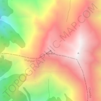
Name: Kankot topographic map, elevation, terrain.

Location: Kankot, Chamba, Himachal Pradesh, India (32.39615 76.24781 32.39625 76.24791)

Average elevation: 11,847 ft

Minimum elevation: 9,062 ft

Maximum elevation: 13,701 ft

Gear up for your next adventure:

🕶️GPS Smartphone Mount - Secure mount for phone navigation
🧭Pro Hiking Compasses - High-accuracy liquid-filled compasses for topographic orientation
📖Nature Tracking Books - Learn to track wildlife and terrain
👖Convertible Hiking Pants - Versatile zip-off pants for changing altitudes and temperatures
🧤Tactile Hiking Gloves - Keep hands warm while operating GPS and smartphone screens

As an Amazon Associate, this site earns from qualifying purchases at no extra cost to you.