
Thank you for supporting this site ❤️
Make a donation
Make a donation
Gear up for your next adventure:
As an Amazon Associate, this site earns from qualifying purchases at no extra cost to you.
Mamidipally topographic map
Click on the map to display elevation.
Thank you for supporting this site ❤️
Make a donation
Make a donation
Gear up for your next adventure:
As an Amazon Associate, this site earns from qualifying purchases at no extra cost to you.
About this map
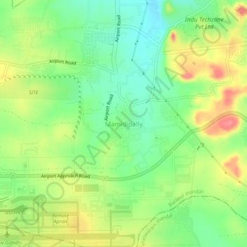
Name: Mamidipally topographic map, elevation, terrain.
Location: Mamidipally, Balapur mandal, Rangareddy, Telangana, India (17.22930 78.43144 17.26930 78.47144)
Average elevation: 1,988 ft
Minimum elevation: 1,877 ft
Maximum elevation: 2,133 ft
Thank you for supporting this site ❤️
Make a donation
Make a donation
Gear up for your next adventure:
As an Amazon Associate, this site earns from qualifying purchases at no extra cost to you.