
Thank you for supporting this site ❤️
Make a donation
Make a donation
Gear up for your next adventure:
As an Amazon Associate, this site earns from qualifying purchases at no extra cost to you.
Coimbrões topographic map
Click on the map to display elevation.
Thank you for supporting this site ❤️
Make a donation
Make a donation
Gear up for your next adventure:
As an Amazon Associate, this site earns from qualifying purchases at no extra cost to you.
About this map
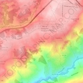
Name: Coimbrões topographic map, elevation, terrain.
Location: Coimbrões, São João de Lourosa, Viseu, 3500-618, Portugal (40.60234 -7.89955 40.64234 -7.85955)
Average elevation: 1,293 ft
Minimum elevation: 712 ft
Maximum elevation: 1,578 ft
Thank you for supporting this site ❤️
Make a donation
Make a donation
Gear up for your next adventure:
As an Amazon Associate, this site earns from qualifying purchases at no extra cost to you.