Geolocate

Semaria topographic map

Click on the map to display elevation.

About this map

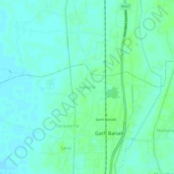
Name: Semaria topographic map, elevation, terrain.

Location: Semaria, Kasba, Purnia district, Bihar, India (25.88930 87.51037 25.92930 87.55037)

Average elevation: 141 ft

Minimum elevation: 128 ft

Maximum elevation: 154 ft

Gear up for your next adventure:

Backpacking Tents - Weight-optimized shelters for multi-day topographic surveys
🏥Hiking First Aid Kits - Comprehensive medical kits for remote trail injuries
🥾Hiking Shoes - Durable and comfortable shoes for trail hiking
🪶Fire Starter Kit - Reliable fire starter for survival and camping
🔭Stargazing Telescopes - Perfect for camping in low-light pollution areas shown on maps

As an Amazon Associate, this site earns from qualifying purchases at no extra cost to you.