
Chihuahuan Desert topographic map
Interactive map
Click on the map to display elevation.
About this map
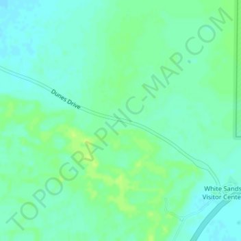
Name: Chihuahuan Desert topographic map, elevation, terrain.
Location: Chihuahuan Desert, Otero County, New Mexico, United States (32.78739 -106.18660 32.78749 -106.18650)
Average elevation: 4,006 ft
Minimum elevation: 3,986 ft
Maximum elevation: 4,029 ft
There are several larger mountain ranges in the Chihuahan Desert, including the Sierra Madre, the Sierra del Carmen, the Organ Mountains, the Franklin Mountains, the Sacramento Mountains, the Chisos Mountains, the Guadalupe Mountains, and the Davis Mountains. These create "sky islands" of cooler, wetter, climates adjacent to, or within the desert, and such elevated areas have both coniferous and broadleaf woodlands, including forests along drainages and favored exposures. The lower elevations of the Sandia–Manzano Mountains, the Magdalena–San Mateo Mountains, and the Gila Region partly border the Chihuahuan Desert and partly border other ecoregions that are not deserts.
Other topographic maps
Click on a map to view its topography, its elevation and its terrain.
Mayhill
United States > New Mexico > Otero County
Mayhill, Otero County, New Mexico, United States
Average elevation: 6,903 ft
Cloudcroft
United States > New Mexico > Otero County
Cloudcroft, Otero County, New Mexico, United States
Average elevation: 8,671 ft
Bent
United States > New Mexico > Otero County
Bent, Otero County, New Mexico, 88314, United States
Average elevation: 6,093 ft
Cloudcroft
United States > New Mexico > Otero County > Cloudcroft
Cloudcroft, Otero County, New Mexico, 88317, United States
Average elevation: 8,648 ft
Sunspot
United States > New Mexico > Otero County
Sunspot, Otero County, New Mexico, 88349, United States
Average elevation: 8,615 ft
Tularosa
United States > New Mexico > Otero County > Tularosa
Tularosa, Otero County, New Mexico, 88352, United States
Average elevation: 4,498 ft