Geolocate

Waterford topographic map

Click on the map to display elevation.

About this map

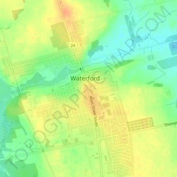
Name: Waterford topographic map, elevation, terrain.

Location: Waterford, Norfolk County, Ontario, N0E 1Y0, Canada (42.92291 -80.30002 42.94291 -80.28002)

Average elevation: 791 ft

Minimum elevation: 725 ft

Maximum elevation: 850 ft

Gear up for your next adventure:

🪶Thermal Camp Blanket - Extra warmth for cold nights
🪶Camping Sleeping Pad - Comfortable sleeping pad for backpacking
🥤Water Filter Bottle - All‑in‑one filter bottle for safe hydration
🌐World Map Poster - Decorative world maps with topographic info
👖Convertible Hiking Pants - Versatile zip-off pants for changing altitudes and temperatures

As an Amazon Associate, this site earns from qualifying purchases at no extra cost to you.