Geolocate

Beulah topographic map

Click on the map to display elevation.

About this map

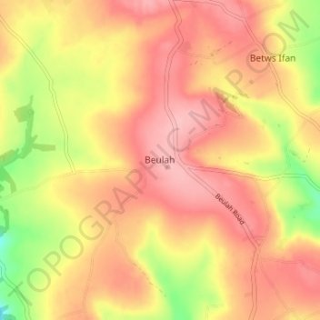
Name: Beulah topographic map, elevation, terrain.

Location: Beulah, Ceredigion, Wales, SA38 9QB, United Kingdom (52.06723 -4.52187 52.10723 -4.48187)

Average elevation: 456 ft

Minimum elevation: 200 ft

Maximum elevation: 604 ft

Gear up for your next adventure:

🗃️Trail First Aid Kit - Essential kit for outdoor injuries and emergencies
🪶Multi‑Purpose Knife - Useful blade for camp and trail
🧣Hiking Neck Gaiter - Multi‑use neck protection for outdoor weather
🌡️Portable Weather Meter - Track weather conditions on the trail
🧦Hiking Socks - Comfortable socks to prevent blisters on long hikes

As an Amazon Associate, this site earns from qualifying purchases at no extra cost to you.