
Spencer topographic map
Click on the map to display elevation.
About this map
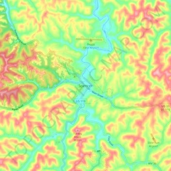
Name: Spencer topographic map, elevation, terrain.
Location: Spencer, Roane County, West Virginia, 25276, United States (38.76214 -81.39098 38.84214 -81.31098)
Average elevation: 919 ft
Minimum elevation: 682 ft
Maximum elevation: 1,184 ft
Roane County trails, hiking, mountain biking, running and outdoor activities