Geolocate

Hermann topographic map

Click on the map to display elevation.

About this map

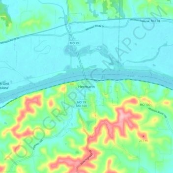
Name: Hermann topographic map, elevation, terrain.

Location: Hermann, Gasconade County, Missouri, 65941, United States (38.66421 -91.47738 38.74421 -91.39738)

Average elevation: 597 ft

Minimum elevation: 489 ft

Maximum elevation: 965 ft

Gasconade County trails, hiking, mountain biking, running and outdoor activities

Gear up for your next adventure:

🔦Powerful Headlamps - Ultra-bright hands-free lighting for night navigation
🛡️Insect Repellent - Protection against bugs during outdoor activities
🗺️Topographic Maps - Detailed topo maps for hiking, exploring and outdoor navigation
🧦Merino Wool Socks - Moisture-wicking, blister-preventing socks for long treks
🎁Geography Themed Gifts - Unique gift ideas for map lovers and geography enthusiasts

As an Amazon Associate, this site earns from qualifying purchases at no extra cost to you.