Geolocate

Prenza topographic map

Click on the map to display elevation.

About this map

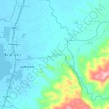
Name: Prenza topographic map, elevation, terrain.

Location: Prenza, Cebu, Central Visayas, 6041, Philippines (10.48479 123.71053 10.52479 123.75053)

Average elevation: 131 ft

Minimum elevation: -7 ft

Maximum elevation: 738 ft

Gear up for your next adventure:

📱Heavy-Duty Phone Cases - Drop-proof and waterproof protection for outdoor navigation
🪶Thermal Camp Blanket - Extra warmth for cold nights
🥾Women's Hiking Boots - Top-rated trail boots with ankle support and superior grip
🛡️Bear Spray Outdoor - Protection in bear country hikes
📖Nature Tracking Books - Learn to track wildlife and terrain

As an Amazon Associate, this site earns from qualifying purchases at no extra cost to you.