Geolocate

Saticoy topographic map

Click on the map to display elevation.

About this map

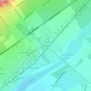
Name: Saticoy topographic map, elevation, terrain.

Location: Saticoy, Ventura County, California, 93004, United States (34.26364 -119.16907 34.30364 -119.12907)

Average elevation: 180 ft

Minimum elevation: 79 ft

Maximum elevation: 541 ft

Ventura County trails, hiking, mountain biking, running and outdoor activities

Gear up for your next adventure:

🪓Survival Multi‑Tool - Versatile tool for camp and trail tasks
🏔️Mountain Trail Maps - High‑detail maps for popular peaks
🪶Camp Gear Gift Set - Perfect gift bundle for outdoor fans
🔥Camping Stove - Portable stove for camping and backcountry cooking
🚑Emergency Bivvies - Heat-reflective sleeping bags for survival situations

As an Amazon Associate, this site earns from qualifying purchases at no extra cost to you.