Geolocate

Buckley topographic map

Click on the map to display elevation.

About this map

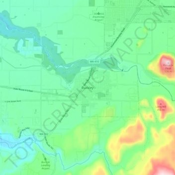
Name: Buckley topographic map, elevation, terrain.

Location: Buckley, Pierce County, Washington, United States (47.12225 -122.06775 47.20225 -121.98775)

Average elevation: 771 ft

Minimum elevation: 446 ft

Maximum elevation: 1,739 ft

Pierce County trails, hiking, mountain biking, running and outdoor activities

Gear up for your next adventure:

🧷Carabiner Set - Durable clips for gear attachment
🪶Fire Starter Kit - Reliable fire starter for survival and camping
🗺️NatGeo Topo Maps - High-quality waterproof printed topographic maps of US Parks
🔌Solar Panel Charger - Charge gear sustainably outdoors
🗻Climbing Gear Basics - Essential gear for beginner climbers

As an Amazon Associate, this site earns from qualifying purchases at no extra cost to you.