Geolocate

1156 topographic map

Click on the map to display elevation.

About this map

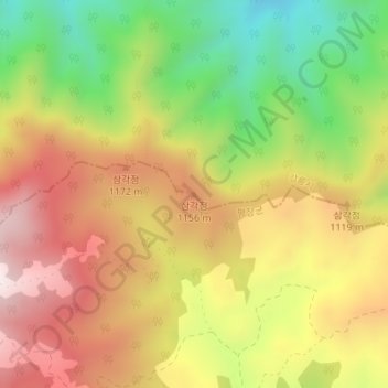
Name: 1156 topographic map, elevation, terrain.

Location: 1156, Pyeongchang-gun, Gangwon, South Korea (37.77073 128.68969 37.77083 128.68979)

Average elevation: 3,330 ft

Minimum elevation: 2,234 ft

Maximum elevation: 4,331 ft

Gear up for your next adventure:

Backpacking Tents - Weight-optimized shelters for multi-day topographic surveys
🪶Camp Gear Gift Set - Perfect gift bundle for outdoor fans
🔋Solar Power Banks - Keep your GPS and phone charged in remote wilderness areas
❄️Traction Cleats - Prevent slips on icy trails during winter hikes
🎒Trail Energy Bars - High‑calorie bars for hiking energy

As an Amazon Associate, this site earns from qualifying purchases at no extra cost to you.