
Rush City topographic map
Click on the map to display elevation.
About this map
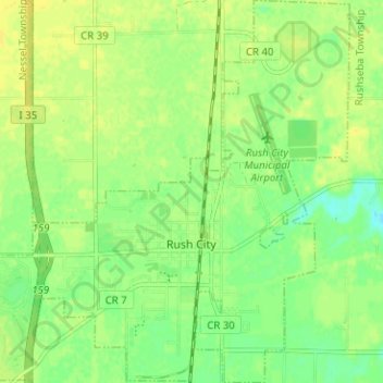
Name: Rush City topographic map, elevation, terrain.
Location: Rush City, Chisago County, Minnesota, United States (45.66953 -93.00209 45.71359 -92.93937)
Average elevation: 922 ft
Minimum elevation: 886 ft
Maximum elevation: 945 ft
Chisago County trails, hiking, mountain biking, running and outdoor activities
Other topographic maps
Click on a map to view its topography, its elevation and its terrain.
Chain Lake
United States > Minnesota > Chisago County > North Branch > Harris
Average elevation: 922 ft