Geolocate

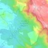
Tholicode topographic map

Click on the map to display elevation.

About this map

Name: Tholicode topographic map, elevation, terrain.

Location: Tholicode, Nedumangad, Thiruvananthapuram, Kerala, 695547, India (8.62525 77.03508 8.66525 77.07508)

Average elevation: 436 ft

Minimum elevation: 236 ft

Maximum elevation: 988 ft

Other topographic maps

Click on a map to view its topography, its elevation and its terrain.
Aryanad

India > Kerala > Nedumangad > Aryanad

Average elevation: 344 ft

Wildlife Sanctuary, Peppara

India > Kerala > Nedumangad

Average elevation: 1,768 ft

Manickal

India > Kerala > Nedumangad > Vettinad

Average elevation: 220 ft

Gear up for your next adventure:

🧺Microfiber Travel Towels - Compact and fast-drying towels for trail use
🦶Hiking Gaiters - Keep debris and water out of your boots
🗺️NatGeo Topo Maps - High-quality waterproof printed topographic maps of US Parks
⛺Backpacking Tents - Weight-optimized shelters for multi-day topographic surveys
🧥Waterproof Jacket for Hiking - Breathable and rugged rain jacket for outdoor excursions

As an Amazon Associate, this site earns from qualifying purchases at no extra cost to you.