Geolocate

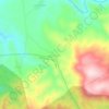
Sadra topographic map

Click on the map to display elevation.

About this map

Name: Sadra topographic map, elevation, terrain.

Location: Sadra, Shiraz Central District, Shiraz County, Fars Province, Iran (29.75499 52.41367 29.84605 52.57813)

Average elevation: 6,070 ft

Minimum elevation: 5,226 ft

Maximum elevation: 7,598 ft

Other topographic maps

Click on a map to view its topography, its elevation and its terrain.

Darian

Iran > Fars Province > Shiraz County

Average elevation: 5,387 ft

Darian

Iran > Fars Province > Shiraz County

Average elevation: 5,387 ft

Darreh

Iran > Fars Province > Shiraz County > دهستان سیاخ

Average elevation: 5,778 ft

Gear up for your next adventure:

🧢Sun Protection Hats - Wide-brimmed and UPF-rated hats for high-altitude sun safety
🧯Emergency Survival Kit - All‑in‑one survival essentials for the backcountry
🪶Thermal Camp Blanket - Extra warmth for cold nights
🪵Folding Camp Saw - Compact saw for wood and campsite work
🎁Geography Themed Gifts - Unique gift ideas for map lovers and geography enthusiasts

As an Amazon Associate, this site earns from qualifying purchases at no extra cost to you.