
Thank you for supporting this site ❤️
Make a donation
Make a donation
Gear up for your next adventure:
As an Amazon Associate, this site earns from qualifying purchases at no extra cost to you.
Mlandi topographic map
Click on the map to display elevation.
Thank you for supporting this site ❤️
Make a donation
Make a donation
Gear up for your next adventure:
As an Amazon Associate, this site earns from qualifying purchases at no extra cost to you.
About this map
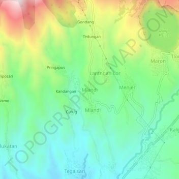
Name: Mlandi topographic map, elevation, terrain.
Location: Mlandi, Wonosobo, Central Java, Java, Indonesia (-7.30156 109.88889 -7.26156 109.92889)
Average elevation: 3,720 ft
Minimum elevation: 2,953 ft
Maximum elevation: 5,312 ft
Thank you for supporting this site ❤️
Make a donation
Make a donation
Gear up for your next adventure:
As an Amazon Associate, this site earns from qualifying purchases at no extra cost to you.