Geolocate

Westmarsh topographic map

Click on the map to display elevation.

About this map

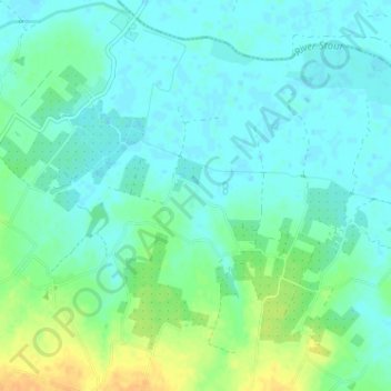
Name: Westmarsh topographic map, elevation, terrain.

Location: Westmarsh, Ash, Dover, Kent, England, CT3 2LS, United Kingdom (51.28601 1.24566 51.32601 1.28566)

Average elevation: 26 ft

Minimum elevation: -3 ft

Maximum elevation: 92 ft

Other topographic maps

Click on a map to view its topography, its elevation and its terrain.

River Stour

United Kingdom > England > Kent > Dover > Ash

Average elevation: 10 ft

Gear up for your next adventure:

🧥Waterproof Jacket for Hiking - Breathable and rugged rain jacket for outdoor excursions
🧭GPS Watch Accessories - Bands and chargers for GPS watches
🧤Hiking Gloves - Protective gloves for rugged trails
🧦Merino Wool Socks - Moisture-wicking, blister-preventing socks for long treks
🧯Emergency Survival Kit - All‑in‑one survival essentials for the backcountry

As an Amazon Associate, this site earns from qualifying purchases at no extra cost to you.