
Thank you for supporting this site ❤️
Make a donation
Make a donation
Gear up for your next adventure:
As an Amazon Associate, this site earns from qualifying purchases at no extra cost to you.
Mohr topographic map
Click on the map to display elevation.
Thank you for supporting this site ❤️
Make a donation
Make a donation
Gear up for your next adventure:
As an Amazon Associate, this site earns from qualifying purchases at no extra cost to you.
About this map
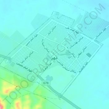
Name: Mohr topographic map, elevation, terrain.
Location: Mohr, بخش مرکزی, Mohr County, Fars Province, Iran (27.54146 52.86664 27.56294 52.89574)
Average elevation: 1,453 ft
Minimum elevation: 1,391 ft
Maximum elevation: 1,824 ft
Thank you for supporting this site ❤️
Make a donation
Make a donation
Gear up for your next adventure:
As an Amazon Associate, this site earns from qualifying purchases at no extra cost to you.