
Thank you for supporting this site ❤️
Make a donation
Make a donation
Gear up for your next adventure:
As an Amazon Associate, this site earns from qualifying purchases at no extra cost to you.
Baxtla topographic map
Click on the map to display elevation.
Thank you for supporting this site ❤️
Make a donation
Make a donation
Gear up for your next adventure:
As an Amazon Associate, this site earns from qualifying purchases at no extra cost to you.
About this map
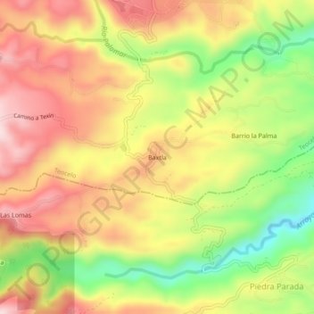
Name: Baxtla topographic map, elevation, terrain.
Location: Baxtla, Teocelo, Veracruz, 91615, México (19.34194 -96.99611 19.38194 -96.95611)
Average elevation: 3,599 ft
Minimum elevation: 2,963 ft
Maximum elevation: 4,124 ft
Thank you for supporting this site ❤️
Make a donation
Make a donation
Gear up for your next adventure:
As an Amazon Associate, this site earns from qualifying purchases at no extra cost to you.