
Thank you for supporting this site ❤️
Make a donation
Make a donation
Gear up for your next adventure:
As an Amazon Associate, this site earns from qualifying purchases at no extra cost to you.
Strettola topographic map
Click on the map to display elevation.
Thank you for supporting this site ❤️
Make a donation
Make a donation
Gear up for your next adventure:
As an Amazon Associate, this site earns from qualifying purchases at no extra cost to you.
About this map
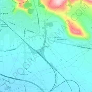
Name: Strettola topographic map, elevation, terrain.
Location: Strettola, Maddaloni, Caserta, Campania, 81024, Italia (41.00574 14.38457 41.04574 14.42457)
Average elevation: 249 ft
Minimum elevation: 75 ft
Maximum elevation: 1,070 ft
Thank you for supporting this site ❤️
Make a donation
Make a donation
Gear up for your next adventure:
As an Amazon Associate, this site earns from qualifying purchases at no extra cost to you.