
Make a donation
Gear up for your next adventure:
As an Amazon Associate, this site earns from qualifying purchases at no extra cost to you.
Tepexpan topographic map
Click on the map to display elevation.
Make a donation
Gear up for your next adventure:
As an Amazon Associate, this site earns from qualifying purchases at no extra cost to you.
About this map
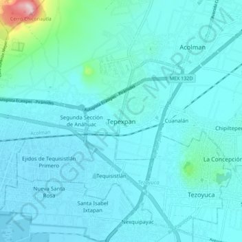
Name: Tepexpan topographic map, elevation, terrain.
Location: Tepexpan, Acolman, State of Mexico, 55885, Mexico (19.57440 -98.97602 19.65440 -98.89602)
Average elevation: 7,434 ft
Minimum elevation: 7,323 ft
Maximum elevation: 8,504 ft
Make a donation
Gear up for your next adventure:
As an Amazon Associate, this site earns from qualifying purchases at no extra cost to you.
Other topographic maps
Click on a map to view its topography, its elevation and its terrain.
Acolman
The municipality is located on a plain in the northern portion of the Valley of Mexico called the Valley of Teotihuacan. It has only three significant elevations. The eastern border is marked by the Sierra de Patlachique and the west is marked by a mountain called Chiconautla. Chiconautla and Tlahuilco are…
Average elevation: 7,539 ft
Make a donation
Gear up for your next adventure:
As an Amazon Associate, this site earns from qualifying purchases at no extra cost to you.
Make a donation
Gear up for your next adventure:
As an Amazon Associate, this site earns from qualifying purchases at no extra cost to you.
Tenancingo
The seat of the municipality is the town of Tenancingo, surrounded by mountains and forest. The main elevation overlooking the town is the Cerro de las Tres Marías, topped by a giant white statue of Christ the King (Cristo Rey), built in 1985, designed by Hector Morret and visible from just about anywhere in…
Average elevation: 6,736 ft
Temascalcingo
The town today has an altitude of 2,380 meters and in 2005 had a population of 11,454 people. The town is centered on a square called the Plaza Centenario, with its Municipal Palace to the south of the square. To the north is another, smaller square dedicated to painter José María Velasco.
Average elevation: 8,540 ft
Make a donation
Gear up for your next adventure:
As an Amazon Associate, this site earns from qualifying purchases at no extra cost to you.
Make a donation
Gear up for your next adventure:
As an Amazon Associate, this site earns from qualifying purchases at no extra cost to you.
Nezahualcóyotl
The municipality has a territory of 63.44 km2, 81% of which is occupied by the city, which consists of 86 neighborhoods called colonias. The rest is part of the Federal Zone of the Ex-Basin of Texcoco. The municipality is flat with only one elevation reading 1,220 meters above sea level. The Los Remedios and a…
Average elevation: 7,333 ft
Tonatico
Mexico > State of Mexico > Tonatico
Tonatico has several nearby mountains, including La Cruz and Tapachichi. The largest is La Puerta at 1,685 meters of elevation. The Salto de Zumpantitlán waterfall is nearby, along with the Tenancingo, San Geronimo and Taplalla rivers.
Average elevation: 5,305 ft
Make a donation
Gear up for your next adventure:
As an Amazon Associate, this site earns from qualifying purchases at no extra cost to you.