Geolocate

Timau topographic map

Click on the map to display elevation.

About this map

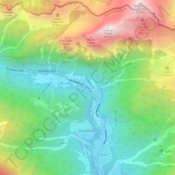
Name: Timau topographic map, elevation, terrain.

Location: Timau, Paluzza, Udine, Friuli-Venezia Giulia, 33026, Italy (46.56290 12.98393 46.60290 13.02393)

Average elevation: 4,288 ft

Minimum elevation: 2,625 ft

Maximum elevation: 7,201 ft

Other topographic maps

Click on a map to view its topography, its elevation and its terrain.

Codroipo

Italy > Friuli-Venezia Giulia > Udine

Average elevation: 135 ft

Gear up for your next adventure:

🪶Thermal Camp Blanket - Extra warmth for cold nights
🪓Survival Multi‑Tool - Versatile tool for camp and trail tasks
🩳Quick‑Dry Hiking Shorts - Comfortable and quick‑dry shorts for summer hiking
🔋Rechargeable Batteries - Power up your outdoor devices
🎒Waterproof Dry Bags - Keep your electronics and maps dry inside your pack

As an Amazon Associate, this site earns from qualifying purchases at no extra cost to you.