
Thank you for supporting this site ❤️
Make a donation
Make a donation
Gear up for your next adventure:
As an Amazon Associate, this site earns from qualifying purchases at no extra cost to you.
Yên Trung topographic map
Click on the map to display elevation.
Thank you for supporting this site ❤️
Make a donation
Make a donation
Gear up for your next adventure:
As an Amazon Associate, this site earns from qualifying purchases at no extra cost to you.
About this map
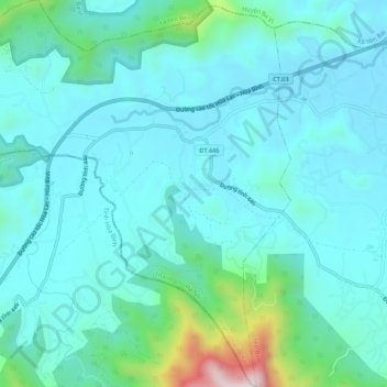
Name: Yên Trung topographic map, elevation, terrain.
Location: Yên Trung, Thach That District, Hà Nội, Vietnam (20.96854 105.39192 21.01809 105.44456)
Average elevation: 433 ft
Minimum elevation: 108 ft
Maximum elevation: 2,192 ft
Thank you for supporting this site ❤️
Make a donation
Make a donation
Gear up for your next adventure:
As an Amazon Associate, this site earns from qualifying purchases at no extra cost to you.