Geolocate

Arcola topographic map

Click on the map to display elevation.

About this map

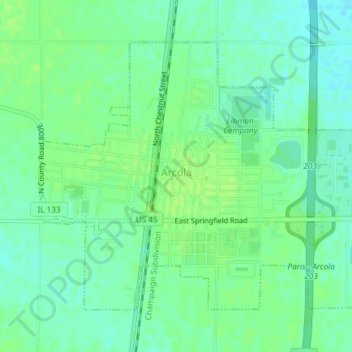
Name: Arcola topographic map, elevation, terrain.

Location: Arcola, Douglas County, Illinois, 61910, United States (39.67357 -88.32082 39.69537 -88.28359)

Average elevation: 676 ft

Minimum elevation: 653 ft

Maximum elevation: 692 ft

Douglas County trails, hiking, mountain biking, running and outdoor activities

Gear up for your next adventure:

🧢Outdoor Hiking Hat - Sun protection hat for outdoor explorers
🔪Outdoor Multitools - Essential survival tools for gear repair and field use
🪶Thermal Camp Blanket - Extra warmth for cold nights
📱Solar Portable Charger - Solar power bank for charging devices off‑grid
🏔️Mountain Trail Maps - High‑detail maps for popular peaks

As an Amazon Associate, this site earns from qualifying purchases at no extra cost to you.