
Thank you for supporting this site ❤️
Make a donation
Make a donation
Gear up for your next adventure:
As an Amazon Associate, this site earns from qualifying purchases at no extra cost to you.
Colibași topographic map
Click on the map to display elevation.
Thank you for supporting this site ❤️
Make a donation
Make a donation
Gear up for your next adventure:
As an Amazon Associate, this site earns from qualifying purchases at no extra cost to you.
About this map
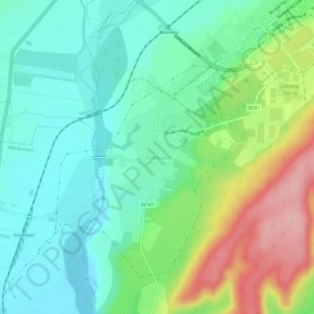
Name: Colibași topographic map, elevation, terrain.
Location: Colibași, Mioveni, Argeș, 115402, Romania (44.91545 24.88881 44.95545 24.92881)
Average elevation: 1,063 ft
Minimum elevation: 902 ft
Maximum elevation: 1,414 ft
Thank you for supporting this site ❤️
Make a donation
Make a donation
Gear up for your next adventure:
As an Amazon Associate, this site earns from qualifying purchases at no extra cost to you.