Geolocate

Peotone topographic map

Click on the map to display elevation.

About this map

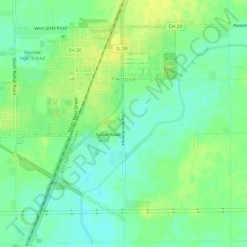
Name: Peotone topographic map, elevation, terrain.

Location: Peotone, Will County, Illinois, United States (41.31324 -87.82010 41.33952 -87.77578)

Average elevation: 705 ft

Minimum elevation: 676 ft

Maximum elevation: 735 ft

Will County trails, hiking, mountain biking, running and outdoor activities

Other topographic maps

Click on a map to view its topography, its elevation and its terrain.

Custer Park

United States > Illinois > Will County

Average elevation: 577 ft

Andres

United States > Illinois > Will County > Andres

Average elevation: 719 ft

Gear up for your next adventure:

🥘Titanium Cookware - Durable, featherlight pots and pans for backpacking
🛠️Outdoor Gear Repair Kit - Essential tools to fix gear on the trail
🎒Outdoor Daypacks - Lightweight backpacks designed for carrying maps and essential gear
🥩Freeze-Dried Meals - Nutritious and lightweight food for remote expeditions
📷Action Cameras - Rugged cameras to document your journeys across rugged terrain

As an Amazon Associate, this site earns from qualifying purchases at no extra cost to you.