
Thank you for supporting this site ❤️
Make a donation
Make a donation
Gear up for your next adventure:
As an Amazon Associate, this site earns from qualifying purchases at no extra cost to you.
Layo topographic map
Click on the map to display elevation.
Thank you for supporting this site ❤️
Make a donation
Make a donation
Gear up for your next adventure:
As an Amazon Associate, this site earns from qualifying purchases at no extra cost to you.
About this map
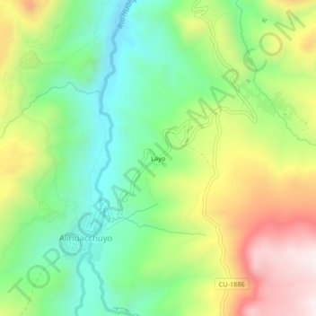
Name: Layo topographic map, elevation, terrain.
Location: Layo, Allhuacchuyo, Santo Tomás, Chumbivilcas, Cusco, Perú (-14.64631 -72.16007 -14.60631 -72.12007)
Average elevation: 13,484 ft
Minimum elevation: 12,566 ft
Maximum elevation: 14,882 ft
Thank you for supporting this site ❤️
Make a donation
Make a donation
Gear up for your next adventure:
As an Amazon Associate, this site earns from qualifying purchases at no extra cost to you.