Geolocate

Chickasha topographic map

Click on the map to display elevation.

About this map

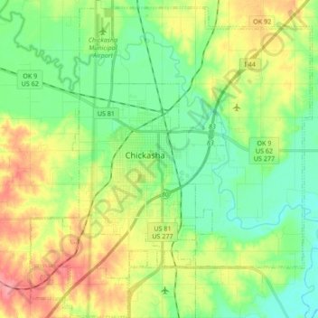
Name: Chickasha topographic map, elevation, terrain.

Location: Chickasha, Grady County, Oklahoma, United States (34.97129 -98.00531 35.10940 -97.85529)

Average elevation: 1,148 ft

Minimum elevation: 1,043 ft

Maximum elevation: 1,335 ft

Grady County trails, hiking, mountain biking, running and outdoor activities

Other topographic maps

Click on a map to view its topography, its elevation and its terrain.

Middleberg

United States > Oklahoma > Grady County

Average elevation: 1,286 ft

Gear up for your next adventure:

🧦Merino Wool Socks - Moisture-wicking, blister-preventing socks for long treks
🌲Outdoor Survival Books - Best books on survival skills
🥾Hiking Shoes - Durable and comfortable shoes for trail hiking
🛏️Cold Weather Sleeping Bag - Warm sleeping bag for cold conditions
☀️Outdoor Sunscreen - High protection sunscreen for outdoor activities

As an Amazon Associate, this site earns from qualifying purchases at no extra cost to you.