Geolocate

maloti topographic map

Click on the map to display elevation.

About this map

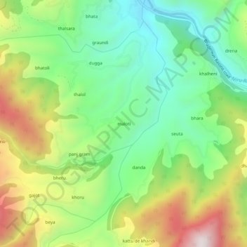
Name: maloti topographic map, elevation, terrain.

Location: maloti, Bhaderwah, Doda district, Jammu and Kashmir, India (33.02878 75.58911 33.06878 75.62911)

Average elevation: 5,003 ft

Minimum elevation: 3,917 ft

Maximum elevation: 6,752 ft

Gear up for your next adventure:

🪄Magnetic Compass - Accurate compass for navigation
🔭Stargazing Telescopes - Perfect for camping in low-light pollution areas shown on maps
😴Insulated Sleeping Pads - Compact and warm pads for high-elevation camping
🏥Hiking First Aid Kits - Comprehensive medical kits for remote trail injuries
🧭Orienteering Set - Complete compass and map reading kit

As an Amazon Associate, this site earns from qualifying purchases at no extra cost to you.