
Thank you for supporting this site ❤️
Make a donation
Make a donation
Gear up for your next adventure:
As an Amazon Associate, this site earns from qualifying purchases at no extra cost to you.
Pozuelos topographic map
Click on the map to display elevation.
Thank you for supporting this site ❤️
Make a donation
Make a donation
Gear up for your next adventure:
As an Amazon Associate, this site earns from qualifying purchases at no extra cost to you.
About this map
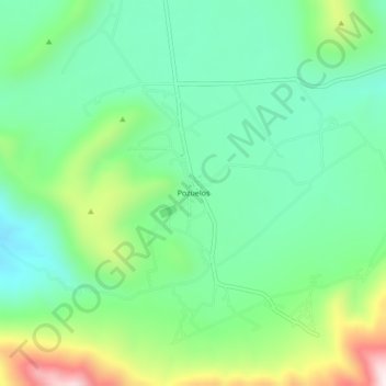
Name: Pozuelos topographic map, elevation, terrain.
Location: Pozuelos, Cardonal, Hidalgo, Mexico (20.47224 -99.07956 20.51224 -99.03956)
Average elevation: 6,778 ft
Minimum elevation: 6,198 ft
Maximum elevation: 8,100 ft
Thank you for supporting this site ❤️
Make a donation
Make a donation
Gear up for your next adventure:
As an Amazon Associate, this site earns from qualifying purchases at no extra cost to you.