
Make a donation
Gear up for your next adventure:
As an Amazon Associate, this site earns from qualifying purchases at no extra cost to you.
Y Mountain topographic map
Click on the map to display elevation.
Make a donation
Gear up for your next adventure:
As an Amazon Associate, this site earns from qualifying purchases at no extra cost to you.
Y Mountain
Y Mountain is a mountain located directly east of Brigham Young University (BYU) in Provo, Utah, United States. The Slide Canyon, or Y Mountain Trail, leads to a large block Y located 1.06 miles (1.71 km) from a parking area at the mountain's base with an elevation gain of 1,074 feet (327 m). This hillside letter was built over a hundred years ago as the insignia for BYU. For years the trail to the Y has been one of the most hiked trails in Utah Valley and provides a scenic view of Provo and Orem, the rest of the many cities in Utah Valley and Utah Lake. The trail is also regularly used by hikers, bikers, paragliders and hunters to access the backcountry in the Slide Canyon area.
Make a donation
Gear up for your next adventure:
As an Amazon Associate, this site earns from qualifying purchases at no extra cost to you.
About this map
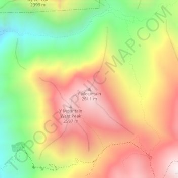
Name: Y Mountain topographic map, elevation, terrain.
Location: Y Mountain, Provo, Utah County, Utah, United States (40.25687 -111.60674 40.25697 -111.60664)
Average elevation: 7,067 ft
Minimum elevation: 5,299 ft
Maximum elevation: 8,691 ft
Make a donation
Gear up for your next adventure:
As an Amazon Associate, this site earns from qualifying purchases at no extra cost to you.